
Moz braces for new storm
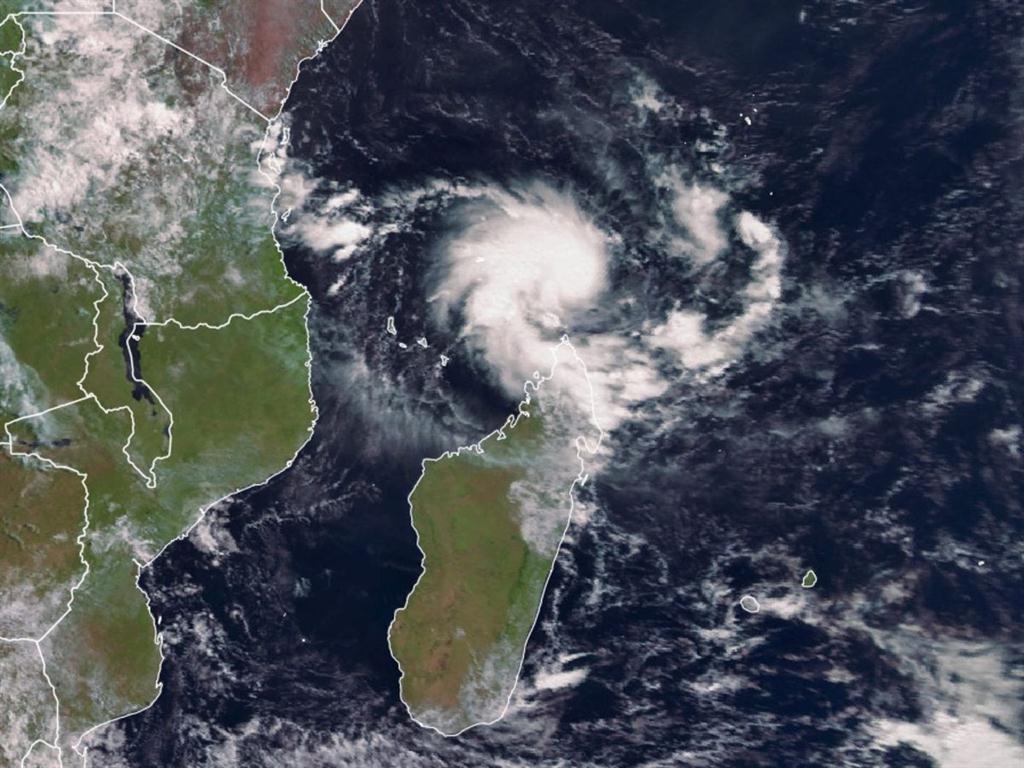
AccuWeather reports that northern Mozambique and southern Tanzania will be hit by Tropical Storm Kenneth later this afternoon or evening as it moves in from north of Madagascar to the south-eastern African coastline.
Yesterday, Kenneth dropped a lot of rain along Madagascar's northern coastline and into the evening Mayotte and the Comoros received heavy rainfall.
“Mayotte may dodge the worst conditions as the strengthening storm tracks north of the island, bringing 25-75 mm of rainfall and gusty winds. Comoros will endure a longer period of stormy weather as Kenneth may strengthen into a tropical cyclone or intense tropical cyclone, producing 75-150 mm of rainfall and damaging winds. Wind gusts up to 130 km/h will be possible across the islands,” the website reported.
Dangerous seas will batter the islands' coastal locations today.
“Further strengthening is possible into Thursday as the storm approaches the southern coast of Tanzania and northern coast of Mozambique.”
Kenneth could make landfall as early as midday today near the border of Tanzania and Mozambique. If Kenneth tracks slower and has more time to strengthen, landfall may not occur until tonight.
Areas near and just inland of this landfall location will be at risk for flooding rainfall, mudslides and damaging winds.
“Locations from Lindi, Tanzania, to Pemba, Mozambique, are most likely to experience the worst of this storm,” AccuWeather says.
While interaction with land will cause Kenneth to weaken as it slowly drifts inland from the coast, torrential rainfall can still trigger flooding and mudslides for locations such as Masasi and Tunduru in Tanzania and Marrupu and Montepuez in Mozambique.
Kenneth may stall or meander over areas just inland from the coast in northern Mozambique and southern Tanzania this weekend.
Rainfall amounts of 200-300 mm are expected from Wednesday through Sunday. AccuWeather says this “amount of rainfall can result in life-threatening flooding and lead to homes being inundated by floodwaters”. There will also be an elevated risk for mudslides in areas of rugged terrain.
The areas that are most at risk from Kenneth were largely spared from any of former Tropical Cyclone Idai's destruction in March.
Many locations in central Mozambique, including Beira, suffered catastrophic damage and are still trying to rebuild and recover from Tropical Cyclone Idai more than a month after the storm's landfall.
Mozambique was particularly hard hit by Idai. According to the United Nations, more than 1 000 people died in the region and at least 131 600 people are still sheltering in 136 displacement sites. More than three million people were affected by Idai in the sub-region. Hundreds are still missing.
Cholera and malaria took hold with a combined 12 000 cases reported since 27 March.
The UN says the number of school-age children affected has risen to 305 700 with more than 3 340 classrooms destroyed.
– Additional reporting by OCHA/AccuWeather
STAFF REPORTER

Comments
Namibian Sun
No comments have been left on this article