
Dineo to hit Namibia this weekend
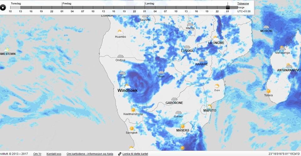
Namibia will feel the impact of tropical storm Dineo this weekend. Certain parts of the country can expect heavy rainfall of more than 50 mm, and flash floods are also likely.
The tropical storm hit the Mozambican coast yesterday morning after being downgraded from cyclone status to a tropical depression.
The South African government warned communities to be on alert for the knock-on effects of the storm.
In Namibia the meteorological service warned that heavy rain of more than 50mm and gusty winds are expected in the Omaheke Region and the eastern parts of Otjozondjupa, Hardap and Khomas this weekend.
Northern Namibia can also expect heavy rainfall this weekend because of a low-pressure system that has developed over Angola.
In the north sporadic flooding has already occurred in some areas.
Dineo was positioned over the Mozambique Channel and after making landfall it weakened to a tropical depression or low-pressure system.
Dineo stormed into Mozambique this week with strong winds which were expected to reach over 200km per hour. Trees were uprooted, roofs torn off and extensive damage was caused to infrastructure.
By yesterday morning the winds had died down to 80 km/hour. The tropical depression is expected to bring torrential rains and strong winds as it moves south-westwards, as can already be seen in South Africa where between 100mm and 200mm in 24 hours was expected in some parts of the country. Tropical storms and cyclones‚ which originate over open water‚ weaken significantly as they pass over land. This is because they depended on the open ocean as a source of latent heat energy to sustain their growth and intensification.
ELLANIE SMIT

Comments
Namibian Sun
No comments have been left on this article